 |
 |
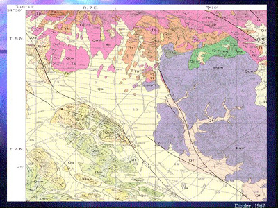
This is a geologic map of the area at 1:62,500 scale. It was
made in 1967 and you can see how much of the fault lines are dashed
with question marks because they were hard to identify.
You can see that the array overlies a lot of Quaternary alluvium.
The purple represents Mesozoic granitic rocks, characteristic
of the Basin and Range.