|
|
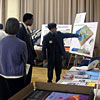
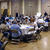
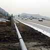
Text and photos by John Marquis The Southern California Integrated GPS Network, or SCIGN, has been under construction for years now, with its roots extending back more than a decade. It has been operational from the beginning, its individual "stations" returning continuous records of their location with millimeter-level accuracy, thanks to the constellation of satellites that make up the Global Positioning System (GPS). Southern California is an area subjected to ever-present tectonic forces that shear, stretch, and compress the Earth's crust in a complex pattern. These slow deformations are eventually accommodated by major faults rupturing in earthquakes. Can a vast array of geodetic instruments, each measuring tectonic movement in its own locality, reveal enough about this pattern of deformation to allow us to more accurately anticipate future earthquakes? That is the question that SCIGN has been created to answer. On July 2, 2001, four days before its scheduled unveiling, SCIGN reached its target goal of 250 operational stations spread out across southern California and northern Baja California, Mexico. On July 6, the SCIGN team officially dedicated this remarkable array with a ceremony held at the Glendale Civic Auditorium. This location was chosen for its proximity to another cutting-edge piece of geodetic instrumentation connected with the SCIGN effort -- a new laser strainmeter currently under construction alongside the Glendale Freeway. The strainmeter will be so sensitive that, according to Frank Wyatt, a SCIGN Coordinating Board member from the Scripps Institution of Oceanography, "if we were to take the L.A. Basin and squeeze it over its entire breadth by no thicker than a human hair, the change would be easily detected." The unveiling event was designed both to commemorate the work of the SCIGN team in creating the array and to introduce and adequately explain the importance of the project to the public, no easy task when presenting something as high-tech and revolutionary as SCIGN. As news crews, dignitaries, and other invited guests arrived, posters were set up in the eastern half of the auditorium to acquaint them with some of the components of SCIGN and related projects. These posters covered topics like the design and placement of the laser strainmeter (the site of which attendees could later visit) and a look at SCIGN's most remote station, GUAX -- a lonely outpost set up on Mexico's Isla Guadelupe with the help of colleagues from CICESE and UNAVCO. SCIGN members circulated about and manned the posters to answer any questions that visitors had before the formal presentations began onstage.
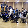
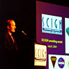
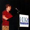
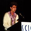
At 11 am, the over 120 people in attendance were called to order by Mark Benthien, Chair of the SCIGN Unveiling Event Committee and Associate Director for Outreach at the Southern California Earthquake Center (SCEC). Once everyone had settled in their seats, Benthien welcomed the audience to the Glendale Civic Auditorium and the SCIGN Unveiling Event. After some brief words of logistical information, he introduced Dr. Thomas Jordan, Director Designate of SCEC and the W.M. Keck Foundation Professor of Earth Science at the University of Southern California (USC), whose research spans such topics as tectonics, geodesy, and marine geology.
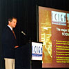
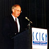
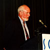
Setting the Stage for the SCIGN Unveiling Dr. Jordan opened his remarks with a welcome to those in attendance, including the representatives of SCIGN's four funding agencies seated onstage: Dr. Ghassem Asrar from the National Aeronautics and Space Administration (NASA), Dr. Ed Stone from the W.M. Keck Foundation, Dr. Margaret Leinen from the National Science Foundation (NSF), and Dr. John Filson of the U.S. Geological Survey (USGS). Literally setting the stage for the many presentations to come, he then declared that "this ceremony marks a very important event in earthquake science -- the establishment of a continuously-monitoring network of geodetic instruments in southern California." To give those audience members not well-versed in earth science a better understanding of the utility of SCIGN, Jordan explained that earthquakes are the ultimate result of "the inexorable motions of the great Pacific and North American plates" squeezing and shearing the crustal blocks of southern California "like so many springs." Since earthquakes occur when these forces overcome the strength of the crust (along a weakened zone -- a fault), the ability to view these motions with unprecedented spatial resolution might ultimately allow scientists "to anticipate future earthquakes with more accuracy, as well as to study in much greater detail the fundamental processes of crustal deformation that are the root causes of earthquakes." This is exactly what SCIGN has been designed to do. After giving a brief overview of the history of SCIGN, a project that, according to Jordan, "did not come cheap, either in terms of dollars or human effort," he described SCIGN's connection to the Southern California Earthquake Center (SCEC). "Following [the 1994 Northridge earthquake], the SCIGN project was organized under the auspices of the Southern California Earthquake Center, which was able to coordinate this project across many participating academic and government units," he said. As much as SCEC has done for SCIGN, "SCIGN is a critical facility for future SCEC activities," Jordan noted, explaining further that "it will provide SCEC scientists with a synoptic view of crustal deformation that will be essential to the improvement of seismic hazard analysis" -- that is, the anticipation of ground motion in an area as caused by future earthquakes. This won't happen overnight, however. Jordan cautioned that the quest for an understanding of earthquakes "is not a short-term proposition," emphasizing that "this ceremony is only the beginning of the SCIGN project," and that "the challenge will now be to sustain SCIGN and the long-term research that it has enabled through our activities and those of the agencies that sponsor SCIGN." He closed his remarks by pledging the commitment of SCEC to that very task.
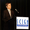
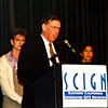
An Overview of the SCIGN Project Dr. Jordan then introduced Dr. Ken Hudnut from the Pasadena office of the United States Geological Survey (USGS). Dr. Hudnut is the Chair of both the SCIGN Coordinating Board and the SCIGN Executive Committee, and in Jordan's words, is "one of the real driving forces behind the SCIGN project." Dr. Hudnut's presentation, a speech coordinated to a series of slides, animations and video clips, summarized many different aspects of the SCIGN project, from its objectives and fundamental principles of operation to actual data produced by the network, which Hudnut called "a state-of-the-art array that leads the world in technical achievements."
According to Hudnut,
SCIGN was built with
four major scientific
objectives in mind. SCIGN is designed to provide regional coverage
for improving estimates of earthquake hazard, identify active blind
thrust faults underneath Los Angeles, measure variations in strain --
like those following the
Dr. Hudnut showed the audience some examples of products generated with SCIGN data -- data, which are freely available to anyone online at www.scign.org. A vector map of crustal velocities illustrated that SCIGN is already estimating rates, he said, "to within the one-millimeter-per-year observational objective we set out to obtain." Another plot showed the "co-seismic jump" in position that occurred during the Hector Mine earthquake, but many miles from the fault, demonstrating that "SCIGN shows us how strain is transferred from one event to the next with unprecedented precision." Also included in Hudnut's presentation were a schematic of the laser strainmeter being constructed along the Glendale Freeway, a time-lapse movie of the installation of a single SCIGN station and an animated map of the development of SCIGN, from its early days before the Northridge earthquake, through the rapid growth of the past five years, culminating in the completion of the 250th SCIGN station at Key's View in Joshua Tree National Park. Before concluding his presentation with a photo of this newest station, Hudnut expressed his appreciation to everyone who, collectively, contributed "a tremendous amount of thought, careful consideration, deliberate planning, and plain hard work" to make SCIGN a reality and "an extraordinary partnership, at many levels." The names of the many people who contributed to SCIGN -- so many, it took four slides to list them all! Dr. Hudnut also acknowledged several dignitaries and key individuals from SCIGN funding agencies who made time to be present at the unveiling.
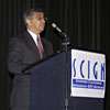
JPL and NASA Apply Space Technology to Earth Science After his presentation, Dr. Hudnut quickly introduced the next set of speakers, who themselves would be making introductions for the representatives of the four major funding agencies of SCIGN. The first of these speakers to follow Ken Hudnut was Dr. Frank Webb, the SCIGN Project Manager at the Jet Propulsion Laboratory (JPL). Dr. Webb briefly described the involvement of JPL in the SCIGN project before turning to his introduction of Dr. Ghassem Asrar, the associate administrator for Earth Sciences at NASA. According to Webb, "it is safe to say that the success of our project would not have been possible without the support of NASA's Earth Science Enterprise and the long-term investments that they have made in space geodesy, GPS technology, and earth science research." With that, Webb turned the podium over to Dr. Asrar. Dr. Asrar began by calling SCIGN's completion an "important new step toward developing our ability to better understand earthquake risk." "With the completion of the SCIGN array," he said, "southern California becomes the premier natural laboratory for earthquake research." And the need for such a laboratory, he noted, is particularly great, given estimates by the Federal Emergency Management Agency (FEMA) that suggest that "earthquakes in California alone cost the U.S. economy nearly $3.3 Billion dollars per year." As staggering as that sum may be, Asrar added that it "cannot begin to convey the cost in human lives or the cost of broken dreams which inevitably result when earthquakes strike without warning." Emphasizing NASA's investment in the use of "space-age geodetic tools" -- such as the Global Positioning System (GPS), Very Long Baseline Interferometry (VLBI), and Interferometric Synthetic Aperture Radar (InSAR) -- to study earthquake potential, Dr. Asrar said that "our near-term goal at NASA is to better understand the mechanics and the physics associated with the tectonic forces" and "the risk associated with these events." Dr. Asrar also expressed NASA's hope that this understanding, combined with sophisticated computer models, might ultimately lead to the ability to forecast earthquakes, in much the same way as weather is currently forecasted. Saying that "the SCIGN array is just the beginning" of the partnership involving NASA, the NSF, and the USGS, Dr. Asrar spoke briefly about the EarthScope initiative, which seeks "to extend the coverage of geodetic sensors for most of the earthquake-prone regions of western North America, from Alaska to southern Mexico." While the technical aspects of this initiative will certainly be challenging, SCIGN may help act as an organizational model for EarthScope, hopefully with similarly successful results. As Dr. Asrar concluded, SCIGN has been "truly a remarkable accomplishment, the first time we've seen such a wide spectrum of institutions and organizations coming together to put their resources and talents toward one of the highest-priority areas of research for our nation."
Keck and SCEC: A History of the SCIGN Proposal Taking the podium after Dr. Asrar was Dr. Tom Henyey, Director of SCEC. Before introducing Dr. Ed Stone of the W.M. Keck Foundation, Henyey gave a brief history of how the SCIGN project came to be, and more to the point, of how Dr. Stone came to be involved in the decision to award a $5.6 million grant to SCEC and SCIGN for the creation of "a first-rate, permanent GPS network in southern California with a principle focus on the greater Los Angeles basin and its seismic hazard." Henyey recalled how "the scientific community first began discussing the desirability of installating a permanent GPS network in southern California in the late 1980s," but that expensive and untested equipment proved a barrier to the realization of that goal. Despite this, several groups of researchers pressed forward with the idea. Their efforts were rewarded once the 1992 Landers and 1994 Northridge earthquakes dramatically demonstrated the need for further research into earthquake hazards in southern California. Henyey suggested that "it's safe to say that these events launched what ultimately became SCIGN." The scientific community began to come together to work on the problem under the auspices of SCEC, and started to "prepare proposals to NSF, NASA, and the USGS." "Then one day," he said, "I got a call from Dr. Sandra Glass, then of the W.M. Keck Foundation, who wanted to come by and talk to me about GPS." The rest is history; SCEC and SCIGN received the grant from the Keck Foundation, and, continued Henyey, "here today is one of the persons who undoubtedly had a role in that decision." That said, Henyey turned over the podium to Dr. Ed Stone, Director Emeritus at JPL, professor of physics at Caltech, and Chair of the W.M. Keck Foundation Science, Engineering and Liberal Arts Grants Program Committee. Dr. Stone outlined four important attributes of SCIGN that influenced the W.M. Keck Foundation's decision to fund the SCEC proposal. The first was the promise that SCIGN would "be of importance to everyone living in southern California," where the Keck Foundation itself is located. The second was the fact that SCIGN was "a high-risk undertaking, but one with the potential of a high return." Because such precision geodesy across as large a baseline as southern California is "a fundamentally new kind of information," Stone stressed that "there are no guarantees as to what will be learned." According to Stone, a third important attribute of the proposal "was the opportunity to catalyze a partnership among top institutions and outstanding researchers to accomplish something that could not have been as effectively pursued individually." He went on to say that "this unveiling today indicates that the GPS Network has indeed been a catalyst, one that has fostered stronger institutional and individual relationships that should benefit future collaborative endeavors." Finally, the fourth important attribute of the SCIGN proposal, Stone said, was its potential to open "the way to future opportunities for science and engineering." It was assumed that SCIGN would "be the first, not the last, step in a new direction for understanding earthquakes," and "would serve as a pathfinder" whose "success would almost certainly encourage even larger steps." SCIGN has definitely lived up to this expectation, having inspired a key component of the EarthScope initiative that involves creating "an array of 1000 GPS sensors covering the entire West Coast of the North American continent." "For these reasons," Stone concluded, "the Keck Foundation is especially pleased to have helped the Southern California Earthquake Center realize this new capability and congratulates and thanks all who have set a new direction in our study of Earth."
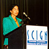
Scripps and NSF: Partners in Making Data Freely Available The next speaker was Dr. Yehuda Bock, a research geodesist at U.C. San Diego's Scripps Institution of Oceanography, a member of the SCIGN Executive Committee, and the director of the Scripps Orbit and Permanent Array Center (SOPAC), which is located at the Institute of Geophysics and Planetary Physics (IGPP) in La Jolla. Bock spoke of SCIGN's predecessor, the Permanent GPS Geodetic Array (PGGA), which started as a partnership of Scripps and JPL scientists twelve years ago. PGGA, which Bock noted was "the first continuous GPS array in the world," led to the creation of several products essential to the SCIGN effort, including GPS orbit products, the SCIGN deeply-anchored monument, and "a world-class archive of continuous GPS data" at SOPAC. This archive now hosts SCIGN data in addition to data from a dozen other networks around the globe. Last year, SOPAC reached a milestone when users dowloaded over one million individual SCIGN data files. In concluding his remarks, Bock said that, "as an academic, I look to the National Science Foundation as a primary source of research funds, and NSF has been instrumental in funding SCIGN from its early days." He explained that it was therefore his pleasure and honor to introduce Dr. Margaret Leinen, the Assistant Director for Geosciences at NSF, chair of the Subcommittee on Global Change, past president of the Oceanography Society, and a well-known researcher in paleo-oceanography and paleoclimatology. "There is a revolution in our ability to observe the Earth," began Dr. Leinen, "and that revolution is being made possible by the Internet and by information technology." She called SCIGN "the first real example of the power of networking a whole array of instruments together to create a measuring device... that is more than the sum of its parts." Reminding the audience of the military roots of GPS technology, she also lauded SCIGN for being "an example the transfer of technologies developed for other purposes for scientific use," through the "innovation and creativity of the scientific community." Each successive major earthquake in southern California during the 1990s showed how SCIGN's spatial and temporal resolution continued to improve as time passed, she said, to the point where "SCIGN stations were even able to measure the seismic wave that propagated through the crust after the Hector Mine earthquake." Dr. Leinen added that SCIGN has not only "demonstrated capabilities for continuous GPS, but it has also led the community in developing completely open data policies for the use of this data." She explained that "SCIGN data are downloaded once a day and immediately made available over the Internet to anyone." Leinen said that "this open data policy is a fundamental characteristic of SCIGN" and important as a model for making the investments of taxpayers accessible "for the benefit of all of us." Dr. Leinen concluded by describing the EarthScope initiative. "Picture first an array of seismometers across the entire country," she asked of the audience. "Then focus in... and picture the extension of the SCIGN array across the entire West Coast," she continued. "Consider an interferometric synthetic aperature radar with the very intense spatial resolution that comes from a satellite," she added, "and finally, picture an observatory drilled into the San Andreas fault." All these together, each "mutually reinforcing and adding to the capabilities of the others," are EarthScope. And that, she said, explains why the funding agencies are "so excited that SCIGN has been a prototype for the development of the capabilities of such a system, and for the development of the partnerships that are necessary to put together an ambitious agenda like that" of EarthScope.
Dr. Jones and Dr. Filson Describe the Involvement of the USGS After Dr. Leinen had finished, the next speaker was Dr. Lucy Jones, the Scientist-in-Charge at the Pasadena office of the U.S. Geological Survey (USGS). Dr. Jones briefly summarized the role of the USGS in the SCIGN project, in which she said USGS scientists have participated from the beginning. She explained that her office, located on the campus of Caltech in Pasadena, is responsible for rapid post-earthquake response, as well as for the field operations of SCIGN, a natural extension of the Geological Survey's role as "the federal agency charged with earthquake monitoring and applied science research for earthquake hazard reduction." She also introduced the next speaker, Dr. John Filson, who has held the role of national coordinator for the Earthquake Hazards Program of the USGS for more than a decade. Jones said that Dr. Filson has "led [the program] through times of great technological innovations, including the development of SCIGN, TriNet, and the Advanced National Seismic System." Dr. Filson began his remarks by conveying the congratulations of Dr. Charles Groat, the director of USGS (whose presence had been requested at another venue by the Secretary of the Interior). He then described in more detail the threefold nature of the work done by the USGS as part of the National Earthquake Hazards Reductions Program. This involves studying the causes and effects of earthquakes, creating earthquake hazard assessments, both on a national and regional scale, and performing earthquake monitoring and notification, which includes providing "rapid and accurate information on location, magnitude, and the distribution and severity of ground shaking just after an earthquake." These duties are especially important in southern California, the site of frequent damaging earthquakes spawned by the interaction of the North American and Pacific plates along their boundary. "In order to understand the physics and structure of the plate boundary," Dr. Filson said, "we need to make measurements both in the seismic domain and in the geodetic domain." With a medical analogy he uses despite the "chagrin of [his] scientific colleagues," he put forth the idea that "seismic networks take the pulse of the Earth, and geodetic networks measure its blood pressure." This need to understand the workings of the Earth in each domain has led the southern California office of the USGS to partner not only in the operation of SCIGN, a geodetic network, but also in TriNet, an extensive network of seismometers across the same region. "Between these two efforts," Dr. Filson claimed, "southern California is one of the best-wired places in the country to measure the effects of and study earthquakes." He went on to say that "what we need to do is to extend the effort in southern California to other parts of the country," something that will be done under two new initiatives, EarthScope and the Advanced National Seismic System. He suggested that what has made SCIGN truly unique is not the scope of the array itself, but the level of cooperation between different agencies and organizations within the project as a whole. This may have been an implication that future initiatives could learn from SCIGN's success, but it was also certainly a factor in his announcement that the USGS is "committed to sustaining [its] support in the operation of SCIGN in the future." Of SCIGN's future, Dr. Filson assured the audience that it would be a bright one, saying, "we are confident that we'll make major discoveries of how the Earth works," with "extensive applications in the engineering and surveying communities," and that, ultimately, SCIGN "will help to lower the risk to society in the southern California area from the earthquake threat."
Use of SCIGN Data beyond Earthquake Research Following Dr. Filson and representing the community of SCIGN data users was Bill Young, a member of the SCIGN Executive Committee from the League of California Surveying Organizations. He pointed out that, in addition to its primary function of returning continuous geodetic measurements, "every SCIGN station that's put in the ground becomes a survey monument" with an accuracy, he claimed, that members of the League "just couldn't believe until we started using the stations." Before introducing the next three speakers, each of whom would represent a particular segment of the users of SCIGN data, Young announced that "the people that make up the League have agreed to supply the manpower to service all of the 250 SCIGN sites, so that we can keep them running indefinitely." Coming from a similar background, the next speaker, Marti Ikehara of the National Geodetic Survey (NGS), also stressed the importance of the precise locations afforded using SCIGN stations as survey monuments. "Precise coordinates," she said, "are the foundation of statewide and nationwide infrastructure, such as freeways and energy and water transmission facilities." SCIGN is of particular value to surveying efforts, she explained, because while "traditional monumentation is increasingly susceptible to destruction by development and construction, SCIGN's CORS [Continuously Operating Reference Stations] have proven to be extremely accurate, reliable, and, so far, indestructible," and the installation of SCIGN stations "dramatically improves precise measurement capability and the science of geodesy."
Next up at the podium was Cecilia Whitaker, a geodetic engineer with the Metropolitan Water District (MWD), who started her remarks on a humorous note, confessing to being a "SCIGN data junkie." She explained that SCIGN data has been a great asset to the MWD's Safety of Dams surveillance program. "Use of the SCIGN network," she pointed out, "has reduced our labor cost with regard to field survey by 50%." This was an important fact, given the many recent retirements of MWD field personnel which coincided with an increased workload brought on by the construction of a new large reservoir in Hemet. "Through the use of the SCIGN network," Whitaker said, "we were able to handle a doubling of our workload due to this new reservoir with a decreased level of personnel, and at the same time were able to improve our accuracy and precision of our measurements." She closed by saying that the "SCIGN network is such a valuable resource and tool for MWD that we have worked with SCIGN to install and maintain 20 of these stations on our important facilities," and that she and her "supervisor have devoted personal time to instruct other members of the land-surveying community in southern California in the use of this resource." The last of the speakers representing the community of SCIGN data users was Don Donofrio of the California Spatial Reference Center. The mission of the Center, he said, is "provide an accurate, uniform -- and for California, most importantly -- an up-to-date geodetic network for the state of California," and he called SCIGN "the backbone for CSRC." In addition to the stations currently in place, he announced that the CSRC has "plans to put a few additional stations in California in areas that are not traditionally of interest to the seismic community -- to wit, the subsidence areas of the Central Valley, Santa Clara Valley, and a few other places." SCIGN, he said, was essential as the "basis for a reobservation of the survey monuments in the vicinity of the Hector Mine earthquake," a process of survey realignment that's been done after every major earthquake in California since 1990. Those at the CSRC, Donofrio declared, "look forward to continued cooperation with the SCIGN network" and "certainly appreciate your financial support," which he noted "the CSRC couldn't function without."
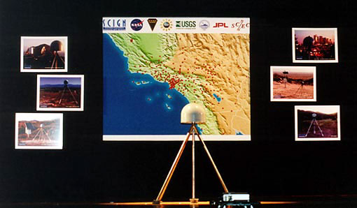
Perspectives from Caltrans and OES Ken Hudnut next introduced Doug Failing, chief deputy of Caltrans District 7, and thanked Caltrans for the permission to install the laser strainmeter along the Glendale Freeway and for their assistance in preparing for the unveiling event. After saluting SCIGN for "outstanding work in the area of earthquake and ground motion research," Doug Failing spoke about the connection between such research and the safety of California's freeway structures. As an example of this connection, he pointed out that, as devastating as the Northridge earthquake was, "not one major freeway structure collapsed during the Northridge earthquake that had undergone seismic retrofit at that time." Addressing the scientists and engineers in the audience, Failing said that this "was due, in a large part, to many of you that are here today." Ending by expressing Caltrans' enthusiasm for a continuing partnership with SCIGN, he stated that "not only does the California Department of Transportation depend on the work of SCIGN, but every resident living here in southern California, in these earthquake-prone areas, are endebted to the efforts made by these scientists and their sponsors." Finally, Ken Hudnut introduced Ed Bortugno, a senior geologist with the California Governor's Office of Emergency Services (OES) and the last of the guest speakers before the final unveiling of SCIGN. First expressing regrets that the director of OES, Dallas Jones, was unable to attend the day's events, Bortugno quickly focused on why a project like SCIGN was important to an office with the primary mission of emergency response. Though OES has become proficient at responding to disasters, Bortugno claimed that simply responding is not enough. "We need to learn to mitigate these disasters and really put that into place," he said, and the scientific investigation facilitated by SCIGN, he continued, "is a key element in this research for us in doing hazard mitigation in California." He also asserted that "some of the real-time aspects involved with SCIGN... are very intriguing to the Office of Emergency Services and we eagerly await being more involved." Bortugno closed with a mention of OES support for the California Integrated Seismic Network to "be funded through the next five years," and again stressed that "this kind of real-time information about earthquakes and about their effects is something that we have come to rely on" at the OES. With a final congratulations to the member agencies and funders of SCIGN, he turned the podium over to Ken Hudnut for the actual ceremonial unveiling. SCIGN is Unveiled Leading up to the moment of the unveiling, SCIGN Chairman Ken Hudnut reiterated that "SCIGN has involved the efforts of hundreds of people and the contributions of many organizations and agencies." He said that "what is about to be unveiled is a tribute to the accomplishments to date, and a symbol of the capability that now exists for understanding earthquakes -- so now, we're pleased to present the operational Southern California Integrated GPS Network." And with that, the lights dimmed and the auditorium went completely dark. After a moment of suspense, the previous backdrop onstage lifted to reveal...
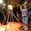
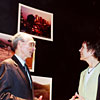
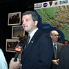
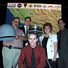
...a full-scale SCIGN monument standing in front of a giant map showing the locations of the SCIGN stations across southern California and northern Mexico. The map was flanked by photographs of stations situated in a diverse range of settings, including a remote island, the barren Colorado desert, and the hills just above downtown Los Angeles. Ken Hudnut then turned the podium over to Mark Benthien, who gave the audience logistical information about lunch, the availability of SCIGN members and agency representatives for interviews, and the tours of the laser strainmeter site, which would continue despite the unexpected rain showers, something not anticipated for the Los Angeles area in early July! Reporters and camera crews were allowed to go up onstage to get pictures of the setup and interviews with the members of SCIGN and representatives of the funding organizations. Once the interviews were over, it was time to have lunch. Lunch provided audience members the opportunity to talk at leisure with those involved in the SCIGN effort.
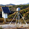
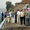
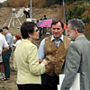
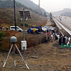
A Field Trip by the Freeway From there, those in attendence were able to take Caltrans shuttle vans from the Civic Auditorium out to the site of the laser strainmeter, just east of the Glendale Freeway between the 134 and 210 Freeways. Once completed, the laser strainmeter will stretch for 600 meters, with a SCIGN station located just above its northern terminus. Visitors to the site were able to get an idea of what the future instrument would look like from some initial construction at the northern end of its length, as well as a display of its blueprints and some of its components. The rain let up enough for many people to get outside and enjoy a brief walk around the laser strainmeter site and the GPS station, creating a sight for curious onlookers who rushed by just a few meters away on the northbound Glendale Freeway. The tour was a great real-world example of the impressive technology and the efforts so frequently lauded by the morning's speeches, and a perfect way to finish a day of celebration for a cutting-edge instrument -- by bringing all the talk of space-age science literally down to earth.
This day might never have happened, however, without the efforts of many who worked behind (and sometimes in front of) the scenes to set up the event. We at SCEC would like to extend our thanks to all those whose hard work and dedication came together so successfully in this grand unveiling of the Southern California Integrated GPS Network, and we hope that this truly is a "SCIGN" of good things to come. For more information about the unveiling event, including the official press release, fact sheet and high-resolution images, please visit our special SCIGN web pages. Complete transcripts of the remarks from all major speakers at the unveiling are also available online, as are the complete set of slides and the full text of Ken Hudnut's presentation. Our thanks to Duncan McIntosh and others at Caltrans for providing many of the photos used in this story. |
|||||||||||||||||||||||||||||||||||
 |
 |
 |
|
|
|
|||
 |
 |
||
Phone 213/740-5843
Fax 213/740-0011
e-mail: SCECinfo@usc.edu